Environmental changes of Nepal Himalaya in terms of GLOF phenomena
Hiroji Fushimi
Kathmandu University
1. Introduction
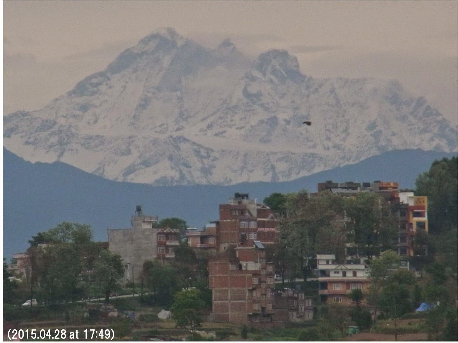
In 1965, I saw Nepal for the first time. I recalls those days when the Kathmandu valley breathed fresh crisp air and the sight of towering Himalaya as well as various species of fishes in the clear Bagmati River simply took my breath away. However now days, the mountains and hills are hidden by thick air pollution and choking dust and in the name of Bagmati are the waste, stench and filth. I would like to remind you to think seriously about the causes and dangerous effects of this environmental deterioration. In 1960’s and 1070’s, there were many cows and dogs in streets clearing up the waste and raw vegetables where there were almost no plastic products and there was fortunately a sustainable circulation in the Kathmandu life environments that is now completely destroyed.
Fig.1 Changes of Kongma Glacier, Khumbu region, east Nepal.
Fig.2 Changes of Gyajo Glacier, Khumbu region, east Nepal.
We will find the similar kind of the great change in Himalayan glacial phenomena. I would like to show you two typical pictures taken in Khumbu region, east Nepal. Figure 1 is the Kongma Glacier located near the Khumbu Glacier of Mt. Everest, the ELA (Equilibrium Line Altitude) located in the middle of the glacier indicateing a heathy glacier in 1970’s, but it raised higher than the glacier altitude meaning all part of the glacier being an ablation area. That is why the glacier melts very fast. Figure 2 is Gyajo Glacier near Namch Bazar, it was also a healthy glacier in 1970, but it retreated very rapidly and became no more glacier to have been a parennial snow pacth in 2009 just like Kongma Glacier (Fig, 1). These glaciers located below 7000 m will be desapear in the middle of this century.
Fig. 3 Construction of the water pipe from Gyajo Khola, Namche Bazar area.
The Gyajo Glacier is an important water resource for Namche Bazar and the near-by villages in the Khumbu region and that is why they are making a hard work to construct a water pipe from Gyajo Glacier (Fig. 3), but people will lose their water resource in near future. It is really happened 5 years ago in Mustang, north central Nepal where people had to leave their villages as an environmental refugee due to the lack of water resource caused by the disappearance of glaciers (Myrepublica, 2010-06-01). This kind of the environmental refugee will happen not only in Nepal, but also in many parts of the South Asia where the Himalaya fed mighty rivers flow down and the level of the river lowers but the ocean level raises due to the global glacier melts as well as oceanic temperature rise, consequently the salt sea water penetrates into river as well as ground water. What will happen then, several hundreds millions people will be environmental refugees in the end of this century in order to get fresh water. I think the change of the Himalayan glaciers will be an important key for the Asian environmental issues in terms of water resources.
This is a report from field works since 1970 in the Nepal Himalaya, and not from desk work.
2. GLOF characteristics of the Nepal Himalaya
Fig.4 GLOF map of the Khunbu region, east Nepal. Yellow circle shows the GLOF small lakes, red dashed line the large lakes and yellow dashed line the small lakes wit the high risk of future GLOF.
Since 1970, many glaciers are receding and at the same time, glacial lakes are expanding in the Khumbu region of east Nepal, and the Mingbo Glacial Lake Outburst Flood (GLOF) occurred in 1977. After that, the Lagmoche GLOF in 1985 and the Saboi GLOF in 1998 were occurred in the Khumbu region (Fig. 4).
The reported GLOFs occurred in the region are smaller glacial lakes which area are less than 1 km2 and no larger glacial lakes such as Glaciers Imja and Tso Rolpa showed any GLOF phenomena. Why is the small glacial lake susceptible and a large glacial lake safe against GLOF in Nepal Himalaya?
All of these valleys eroded by GLOF are clearly seen even in the satellite image shown by the white line due to the eroded valley topography (Fig. 4). However, ther are no such eroded valley topography are seen along the river sides of the larger glacial lakes, Imja and Tso Rolpa.
2-1. Small glacial lake
2-1-1. 1977 Mingbo GLOF
Fig.5 1977 Mingbo GLOF In the left phot, Mingbo valley eroded, Ice coreed moraine and newly formed lake are shown, and the vacant lake and Dudh Kosi hydrograph in the right figure.
The Mingbo (Nare) glacial lake was located in the south of Mt. Ama Dablam, Khumbu region. On 3 Sept., 1977, the lake caused the GLOF (Fig. 5) when we had been making glaciological surveys in the region. So, we went up along the eroded Minbo valley caused by the GLOF (Left photo) and observed the vacant lake 300 m long, 200 m wide and 30 m deep with the terminal moraine destroyed (Upper right). There was an ice-cored moraine (Left photo).
Due to the large amount of debris caused by the GLOF, a new lake was formed in the Imja Khola near Pangboche (Lower left photo), while the river level of Dudh Kosi raised abruptly about 1 m at Raswa Hydrological Station (Lower right). So, the GLOF disasters, such as destruction of roads, bridges and houses near the river bed, were occurred along Dudh Kosi (river).
2-1-2. 1985 Lagmoche GLOF
Fig.6 Lagmoche (Digtso) glacial lake near Thame in the western part of the Khumbu region. End-moraine was destroyed at the 1985 GLOF and the GLOF disaster was reported along the Dudh Kosi river.
The Lagmoche (Digtso) glacial lake near Thame in the western part of the Khumbu region has the steep cliff causing avalanches and rocks directly falling into the lake and huge waves (Tsunami) possibly destroyed the end moraine (Upper right photo) and villages along the river (Lower right photo) by the 1985 GLOF.
2-1-3. 1998 Saboi GLOF
Fig.7 Saboi glacial lake is in the south-eastern part of the Khumbu region and has a steep clif in the upper part of the lake.
Figure 7 is the picture of the Saboi glacial lake as well as its glacier taken from a plane and in field survey I 1976. The Saboi glacial lake in the south-eastern part of the Khumbu region locates in Hinku Khola and has also the steep cliff in the upper part of the lake (Fig. 7) was thought to have destroyed the end moraine by a kind of Tsunami due to the avalanche or rock fall from the steep cliff at the time of the 1998 GLOF.
2-1-4. Gabche GLOF
Fig. 8 Gaptse glacial lake is located at the south face of Mt. Annapurna. Gapche Glacier is fed by avalanche which causes a large wave called “TSUNAMI” to form Glacial lake Outburst Flood (GLOF).
The Gaptse glacial lake locates at the south side of Mt. AnnapurnaⅡ in the central Nepal Himalaya. Manoj and others (2005) reported that “the field verification was not done regarding the nature of glaciated region” So, the field observation was carried out in May 2012 and we found that it is the lowest glacial lake with altitude of 2,500 m a.s.l. in Nepal Himalaya and there is a quite large cliff, which altitude difference is about 4000 m, in the upper part of the glacial lake.
We noticed frequent avalanches from Mt. AnnapurnaⅡand Lamjung Himal, and such avalanches and rock falls create a Tsunami to cause GLOF when they fall directly into the lake. The GLOF disaster occurred along the Madi Khola in 2003, 2005 and 2009 according to the local residents.
2-2. Tulagi glacial lake as a large glacial lake
Fig. 9 The Tulagi glacial lake is located at the upper part of the Dana Khola (river), one of the Marshangdi’s tributary river in the west of Mt. Manaslu and Mt. P29
The Tulagi glacial lake is one of the large glacial lake and located at the upper part of Dana Khola, the Marshangdi’s tributary river in the west of Mt. Manaslu and Mt. Peak 29. Ther is no eroded valley topography caused by GLOF along Dana Khola below the river mouth of Tulagi glacial lake.
2-2-1. Glacial changes
Fig. 10 The changes of the Tulagi glacial lake and its glacier terminus
The changes of the Tulagi glacial lake and its glacier terminus were determined by air photos and field surveys.The lake size is 3 km long, 0.5 km wide and expanded at yearly rates of 31 m from 1975-1992, 47 m from 1992-2005, 68 m from 2005-2008, 60 m from 2008-2009 and no significant change from 2009-2014. The recent changing rate had been accelerating with active calving from 1975 to 2009, but it seems to be settled down and show no remarkable calving phenomena since 2009. The terminus of Tulagi glacier was thought to have stranded on the lake bed.
Fig. 11 Tulagi glacier terminus
The Tulagi glacial lake has the huge debris covered glacier in the upper part receiving avalanches and rock falls from Mt. Manaslu and Mt. Peak 29, which is completely different from the small glacial lakes having the avalanches and rock falls dropping directly into the lake.
2-2-2. Recent changes of the lake level
Fig. 12 The above yellow arrows show the lowering of Tulagi lake level form 1996 to 2009.
As Nepal Department of Hydrology and Meteorology (DHM) made a glaciological survey in 1996, the topographic characteristics were compared with the photographs of 1996 and 2009 in the lower part of the lake, and the lowering of the lake level is clearly shown by the yellow arrows and a clean pond is newly formed due to the sedimentation of glacial clay (glacier milk) at P point (Fig. 12).
Fig. 13 The shore line without vegetations is 2.5 m above the present lake level and the 1996 water gauge has been left higher than the lake level
The shore line without vegetation is 2.5 m above the present lake level (Lower and upper right photo in Fig. 13) and the 1996 water gauge has been left higher than the present lake level (Upper left photo in Fig. 13). The lake level lowered 2.5 m from 1996 to 2009.
2-2-3. Glacial history of the neoglaciation
Fig. 14 Glacial history (glaciations) in Khumbu region, east Nepal.
The plant remnants were sampled from the moraine basement of the Thuklha stage in the Khumbu region. Since the 14C age of the sample is 410±110 yr B.P., the age of the Thuklha stage is the 16th century, beween 15th and 17th century in the neoglaciation (Fushimi, 1981).
Fig. 15 Topography of the terminus of Tulagi glacier lake
Fushimi (1981) reported that the Tulagi glacial lake was formed after the glacial advance in 16th century in the neoglaciation and there is no evidence of the GLOF occurrence indicated by a newly formed river terrace with an eroded valley topography along Dana Khola. At the end-moraine of Tulagi glacial lake between the lower part of the lake and the most upper part of Dana Khola, the river mouth (outlet) is eroded about 30 m from the top of the end moraine formed in 16th century. So, the water level of Tulagi glacial lake has been lowered at the average annual rate of 5 cm due to the outlet erosion at the end moraine since the glacial advance of 16th century that indicates to decrease the GLOF risk.
2-2-4. Moraine structure
Fig.16 Moraine structure. The end moraine structure of Tulagi glacial lake is strong enough to prevent the occurrence of the GLOF
The end moraine structure of Tulagi glacial lakes is wide and strong enough to prevent the occurrence of the GLOF. The lake level of the Tulagi glacial lake has been continuously lowered by the outlet erosion at the end moraine to decrease the GLOF risk and it is occurred without having a man-made canal. The Tulagi glacial lake is thought to have a kind of an autonomous property to prevent the GLOF.
2-2-5. Imja glacial lake
Fig. 17 Changes of the Imja glacial lake from 1975 to 2013.
Figure 17 shows the Imja glacial lake taken in 1975 by plane, and in 2002 (Upper left photo in Fig. 17) and 2013 (Lower left photo in Fig. 17) taken at the field study. The size of Imja glacial lake expanded from 1975 to 2002, but reduced in 2013. The end moraine structure of Imja glacial lake is also wide and strong enough to prevent the occurrence of the GLOF.
Though the Himalayan Times (2013) reported that the United Nations Development Programme (UNDP) and Nepal government made an agreement to build a man-made canal, I would like to recommend to make necessary field observations before taking such project to construct a man-made canal in the pristine nature of the Himalayas.
3. Conclusion
Fig. 18 The small glacial lake, developing in the Hong Khola around Mt. Chamlang.
3-1. GLOF
All of the reported GLOFs occurred in Nepal Himalaya are smaller glacial lakes and no larger glacial lakes such as Glaciers Tulagi, Imja and Tso Rolpa showed any GLOF phenomena before.
Why is a large glacial lake safe against GLOF in Nepal Himalaya? What is the higher risk of the GLOF? It is not a large glacial lake, but a small glacial lake. We must be very careful about the small glacial lakes, for example, a small glacial lake developing in the Hong Khola around Mt. Chamlang (Fig. 18) which have steep cliff to cause avalanches and rock falls that create a Tsunami destroying the end moraine and forming the GLOF, so they must be taken to mitigate against GLOF.
Due to the outlet erosion at the end moraine of the larger glacial lake since the 16th century glacial advance, the lake level has been always lowering and reducing the GLOF risk without having a man-made canal.
As the ICIMOD (2011) reported “Imja glacial lake has less likelihood of outburst than Tulagi lake” and Tulagi glacial lake is safe against GLOF due to an erosion at the end moraine, so both the large glacial lakes such as Tulagi and Imja are safe against GLOF.
3-2. Environmental changes
The International Mountain Museum in Pokhara gets about 1.5-lakh visitors annually and more than a half of them are students coming with school buses from all over Nepal. I prepared a corner section in the Museum dedicated to showing the changes of Himalayan environment, such as glaciers, Glacial Lake Outburst Flood (GLOF), Global Warming and the problems created out of it. I want all the Nepalese people especially the younger impressionable minds to be aware of the fact that Nepal’s environment is also changing rapidly and its effects on the future of the country. I shared my future plans of wanting to make a picture database, about one hundred thousand massive image collections that I donated to the museum.
Fig. 19 The big bats migrated, then what will happen to the crow kingdom! Is this an omen of the Rachel Carson's "Silent Spring"?
As the upper Mustang people already migrated few years ago due to the shortage of water resources caused by the disappearance of glaciers and most of glaciers located below 7,000 m will disappear in the middle of this century, then several hundreds million people in the South Asia living along the mighty rivers of the Himalayan origin will lose the fresh water and they have to migrate as an environmental refugee just like the Mustang people. There are now no big bats used to be in the forest of the old palace in Kathmandu (Lower left photo in Fig.19) and they migrated somewhere. They may be a kind of the environmental refugee indicating our future, then what will happen to the crow kingdom (Fig.19) now seen not only in Kathmandu but also all over in Nepal. If there is nobody living in Kathmandu, the crow can not get foods and they also become an environmental refugee. Finally, will the so called, Rachel Carson’s “Silent Spring” come to Kathmandu in Nepal Himalaya? From that point of view, I am now delivering my lecture “Environmental Changes of the Nepal Himalaya” (Fushimi and Hoshiba, 2015) at Kathmandu University with my hearty condolences to Nepalese people suffered from the huge earhthquake happened on 25 April, 2015.
References
Fushimi et. Al. (1981) Glacial history in the Khumbu region, Nepal Himalayas in relation to upheavals of the Great Himalayas. Symposium on Qinghai-Xizang (Tibet) plateau (beijin, China), 2, 1641-1648.
Fushimi et. al, (1985) Nepal case study: Catastrophic Flood. Techniques for prediction of runoff from glacierized areas, International Association of Hydrological Sciences, 149, 125-130.
Fushimi H. and Hoshiba S. (2015) Kathmandu University Lecture.
http://environmentalchangesofthenepalhimalaya.weebly.com/
ICIMOD (2011) Glacial Lakes and Glacial Lake Outburst Floods in Nepal. Kathmandu: ICIMOD.
Manoj Kr. Ghimire1, Shreekamal Dwivedi and Subhrant K. C.1 2005 Glacial study in Madi watershed with special reference to GLOF of 2003. Journal of Nepal Geological Society, Vol. 32 (Sp. Issue).
Myrepublica 2010-06-01 Nepal's first climate refugee village in Mustang.
http://archives.myrepublica.com/portal/?action=news_details&news_id=19341
Rachel Carson (1962) Silent Spring.
The Himalayan Times (2013-07-15). Nepal, UNDP ink deal on cutting flood risk.
http://southasiarevealed.com/2013/07/16/nepal-undp-ink-deal-cutting-flood-risk/
5月3日から9日にポカラに行き、国際山岳博物館の展示更新をしますので、その期間の講義は、干場悟さんにしていただくことになっています。当初は5月末に講義を終了する計画でしたが、ポカラ行きが早くなりましたので、講義期間は1週間のび、6月5日まで行う予定です。